395 Official Seal
Free online creation of various seals
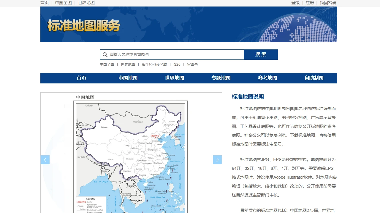
 Standard Map Service System
Can be used as illustrations for news and publicity, illustrations for books and newspapers, background images for advertising displays, base images for handicraft design...
When making a presentation PPT you need a map of China as an illustration, writing an article requires inserting a world political map, or even designing cultural and creative products and wanting to use a map as a base image — these daily needs hide small troubles that people often overlook: if you are not careful, you will come across “problem maps” with incorrect boundary drawings. The Standard Map Service System is an official platform specifically designed to solve such troubles. All maps in the system are drawn in accordance with the standards of China’s and all countries’ national boundaries, which are authoritative, accurate and freely available, making it one of the most reliable channels to obtain compliant maps.
Official website: http://bzdt.ch.mnr.gov.cn/
This Standard Map Service System is built and operated by the natural resources department throughout the process, with the positioning of providing standardized map data and geographic information services to the whole society. It actually undertakes two core tasks: one is to allow ordinary people to easily obtain accurate and authoritative map information; the other is to reduce the occurrence of “problem maps” from the source and safeguard the dignity of the national territory. During development, it also cooperated with internet companies, and the interface and interaction have been optimized, so ordinary users do not need much effort to use it, and the threshold is very low.
There is another small detail to remind everyone: the standard maps on the platform can be viewed and downloaded for free, which is completely fine for personal use. However, if used in public occasions, it is necessary to mark the map approval number as required, which is the most basic requirement for compliant map use. Don’t forget this.
Enter this platform, directly search for the map you need, confirm it by viewing online, then you can download it for free. The maps on the platform not only include those of China, but also cover maps of countries around the world. Whether it is an illustration for news reports or a layout for publications, the accuracy can basically meet the needs. There is no need to look for other channels, just search here, which saves time and is reliable.
If the ready-made maps on the platform cannot meet your personalized needs, the self-service map-making function will come in handy. There is no need to install professional map-making software, you can operate online: select map elements by yourself, adjust the colour scheme, add markers and write text descriptions, and output the finished product directly after modification. Even beginners can easily get started, no need to worry about not being able to operate.
In terms of output formats, the platform supports common file types such as EPS and JPG, which can basically cover both printing and screen display scenarios. However, for professional users who need in-depth processing, the current formats may still be insufficient. People are also looking forward to adding formats such as SHP and AI later, to facilitate secondary editing in GIS and design software. In terms of underlying technology, this platform is built in accordance with OGC standards such as WMS and TMS, supports map tile services, and has multi-map and multi-dimensional display. The stability and compatibility of the service are guaranteed, so there is no need to worry about problems occurring midway.
You may be curious: what exactly can this standard map be used for? In fact, there are quite a few places where it can be used in daily life. For example, when media do news and publicity, it is very suitable to use it as an illustration when reporting current affairs, finance and economics, and international news; geographic illustrations in textbooks, magazines and books can also be directly quoted, without the need to draw boundaries by yourself; background images for advertising displays such as exhibition posters and promotional materials can also be compliant when used as base images; it is also fine to use it as a base image for map elements when designing cultural and creative products and souvenirs; even when compiling public version maps, it can be used as a reference base image, saving the trouble of checking boundaries by yourself.
Whether you are an office worker making a presentation, an author writing an article, or a designer engaged in cultural and creative work, when you need to use a map, you can try this platform first. No need to worry about getting a problematic map, nor the trouble of checking boundaries by yourself, it is worry-free and reliable.